Case Study #5: Water quality benefits of surface stormwater drainage and treatment of parking lot runoff using multi-cell wetlands in parking lot median strips
C.J. Aichinger at the Ramsey-Washington Metro Watershed District.

Project Summary:
The Ramsey-Washington Metro Watershed District (RWMWD) has a continuing goal of looking at alternative approaches for dealing with stormwater runoff treatment. In 1998 the Ramsey-Washington Metro Watershed District, in cooperation with H.B. Fuller Company, studied the water quality benefits, vegetation management issues, and costs of an alternative parking lot design. The study was a comparison between a traditional curb and gutter parking lot and an alternative lot design, which uses interconnected wetland cells to convey stormwater. The monitoring program was funded with a Twin Cities Water Quality Initiative Grant distributed by the Metropolitan Council.
Methods
Water quality monitoring equipment was set-up to capture stormwater runoff and to log flow at each sampling location for as many storm events as possible throughout the season. The project goal was to sample stormwater runoff from at least 10-12 storm events at both the traditional and alternative parking lot designs. Sampling sites were visited every other day or the day after a storm event. Samples were composited and delivered to the lab within 10-24 hours of collection. Storm samples were analyzed using Standard Methods for total phosphorus, soluble reactive phosphorus, and total particulate matter at the Ramsey County Environmental Services Laboratory. The flows were calculated by using v-notch weir equations and data points entered in ISCO samplers. Precipitation data was collected with an on-site Ramsey County Network rain gage monitored by H.B. Fuller Environmental Services staff.
The RWMWD staff biologist performed a qualitative visual vegetation assessment of the wetland cells. All other vegetation and ground maintenance was performed or contracted out by staff from H.B. Fuller. H.B. Fuller staff also monitored ground maintenance costs and problems.
Site Description
The test and control sites are located about 328 yards apart on the H.B. Fuller headquarters campus in the city of Vadnais Heights. The sites are of similar age: both were constructed between the years of 1994-96. The motor vehicle traffic and use patterns are also very similar at both sites.
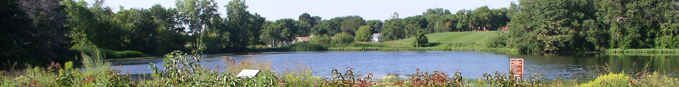
The test site (wetland lot) built in 1996 is a 2.6 acre bituminous parking lot which provides parking for 220 vehicles. The lot is broken up into sections by three vegetated infiltration median strips (figure 1). These infiltration strips or “wetland cells” are inter-connected and outlet to an open water wetland at a single point. All stormwater runoff from this lot under-goes some sort of infiltration or filtration treatment before entering the down stream wetland. Eighty percent of the parking lot drains directly into the wetland cells by way of sheet flow. The remaining twenty percent sheet flows overland through woodland and native prairie grasses to the open water wetland down gradient of the wetland cells.

The control site (Lab A lot) is a traditional bituminous curb and gutter parking lot with raised, manicured medians. The Lab A lot consists of 80 parking spaces with an impervious surface area of 1 acre. Stormwater from the entire 1 acre is collected by two curb catch basins and routed through a 12-inch concrete pipe to a main storm sewer. The stormwater receives no treatment prior to being discharged to a small stormwater wetland on the shores of Willow Lake.
Sampling Site Description
The District staff took great care during the site selection and sampler placement for this study. Many possible comparison sites, sampler locations, and set-ups were reviewed. After much analysis the District staff chose what it felt was the best possible location and sampling configuration that the study budget would allow.

The test site (wetland) sampler was located 100 feet down stream of the last wetland cell. A large hole was excavated down to the 8-inch PVC outlet pipe and a section of the PVC pipe was removed and replaced with a clear acrylic pipe fitted with a v-notch weir insert, bubble tube, and a suction screen. The clear pipe was employed as a visual aid in maintenance and in flow calibration. An ISCO 6700 sampler/flow meter was used to record flow readings and to retrieve flow-weighted samples.
The location for the control sampling site (Lab A lot) was selected because of its proximity to the wetland test site, flow characteristics, and its easy access. The Lab A sampler was located at a catch basin just outside the sampled watershed. An inflatable weir insert equipped with a bubble tube and suction screen was placed inside the 12-inch concrete pipe to gage flow and retrieve samples. Flow data and flow-weighted samples were collected with an ISCO 6700s sampler/flow meter.
Results
During the sampling period of April through November, the Watershed District collected flow weighted samples from 27 storm events. H.B. Fuller staff recorded 28.86 inches of rainfall in their on-site rain gage during this sampling period. 1998 rainfall recorded by H.B. Fuller showed nearly 5 inches above the thirty-year average for April through November in this region.

The test site sampler had much success capturing samples from large storm events. The sampler took samples from 16 storm events with a rainfall depth range of 0.1 inches to 2.12 inches, with a mean depth of 1.0 inches. Fifty percent of the samples were collected from larger storm events (storms > 1 inch). The small storm events (storms< 0.25 inches) were either stored or infiltrated in the wetland cells with little or no runoff recorded at the outlet.
The control/Lab A lot sampler performed remarkably well, collecting samples from 25 storm events. The samples were collected from a wide range of rainfall depths and storm intensities. The storms sampled had rainfall depth ranging from of 0.02 inches to 2.12 inches, with a mean rainfall depth of 0.60 inches. Over 60 percent of the events sampled were from small rainfall events (storms < 0.25 inches).
Total stormwater flow volumes for the sampling period were recorded at both sampling locations. Only flow associated with rainfall events was used in total flow calculation, and this eliminated calculating flow from irrigation. The flow volumes, along with the mean nutrient concentrations from each site, are listed in table 1.

Vegetation Management Issues
The wetland cells were planted with native mesic and wet prairie plant species. The planting of the parking lot cells was started in earnest one year after completion of the lot. During the spring of 1996 the wetland cells were seeded with nearly 50 wetland and prairie species. Seed was again applied in the late fall of 1996 and early spring of 1997 along with some supplemental seedling planting to portions of the cells that received erosion damage. The later seeding and plantings were much more successful than the first 1996 attempt. In the 1998-vegetation assessment, 30 native plant species were recorded in and around the wetland cells. As of the fall of 1998, the wetland cell vegetation appears to be well established, and at this time no further seeding or planting is planned.
The H.B. Fuller ground maintenance staff spent considerable time in 1996-97 establishing and weeding the wetland cells and surrounding upland. The time spent on maintenance was reduced in half for the summer of 1998, and it was projected to be further reduced for the summer of 1999. Table 2 shows a comparison of maintenance man-hours for the two study sites.

Discussion
This study demonstrates that the use of small created wetland depressions in parking lot medians can effectively reduce the stormwater runoff leaving the site. Review of the flow and nutrient data indicates that the wetland cells’ primary function is infiltration and not nutrient removal. The wetland lot discharged nearly 40 percent less stormwater runoff than an equal size curb and gutter site, which calculates into nearly 55,000 cu-ft of nutrient-laden stormwater. To our surprise, we found that the wetland site may have acted as a nutrient source. The test site had a 20 percent higher mean concentration of total phosphorus in its stormwater discharge than did the control site. Further studies revealed that the higher concentrations of nutrients could have come from the landscape material, such as wood chips, applied around the edges of the wetland cells. Although the total phosphorus concentration was higher at the test site, the yearly phosphorus load discharged to its receiving waters was nearly 30 percent less than what the control site discharged. The thirty-percent difference equates to roughly 20 pounds of phosphorus over the course of the year. Nutrient/sediment removal should further improve once the native vegetation is more established and can more effectively slow and infiltrate the stormwater runoff.
The H.B. Fuller project also demonstrated that with time and effort, good quality native vegetated wetlands can be developed in a commercial area. As of the spring of 1999, the vegetation in the wetland cells appears to be well established and flourishing in its new surroundings. However, extensive amounts of time and effort went into getting these wetland cells to their current state. Restoration time could be reduced with better restoration site planning, vegetation installation techniques, and maintenance practices. H.B. Fuller staff implemented many of these planting techniques, such as using seedlings in conjunction with seed and using erosion control material to protect seed bed during germination, later in the project with marked success. The staff also improved mowing and weeding strategies that were suppressing new vegetation growth.
Return to Case Studies.